Roads and road structure
HERE’s road network contains different kinds of road geometry that is displayed by using various colors and icons. To render the correct display and routing information, it is important to accurately define their geometric representation, their traffic significance, and their attributes according to reality and/or local knowledge. The following chapter gives an overview about the structural elements of a road in Map Creator.
1 Road structure
1.1 Road segments
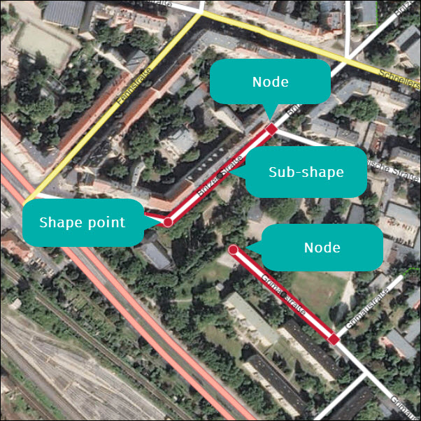
Road segments are the smallest sub-unit of a stretch of a road. The geometric representation of a road segment is defined by its start and end points (nodes) and the shape and sub-shape points along the road segment.
1.2 Nodes
Nodes are the start and end points of a road segment. If the road segment is connected to other segments, the node will be displayed as a red diamond. If a road segment’s node is not connected to anything (e.g. a dead-end road), it will be displayed as a red circle.
1.3 Shape points
Shape points are represented by a red circle and are used to define the shape of a road. They can also indicate the endpoint of a dead-end road.
1.4 Sub-shape points
Sub-shape points are small, dark circles along a road segment. They are created automatically in the middle of the segment. Sub-shape points are important when creating a curved section of a road segment. If you move a sub-shape point to a new position, it turns into a shape point, and two new sub-shape points will be created on either side of the shape point. If needed, you can use the newly created sub-shape points to further define the shape of the road segment.