Road closures and construction
1 How to submit a report
Sometimes we need to report a road that could be closed temporally due to the construction status or other possible problems like an accident or other events.
If you want to submit a report, you have to first select the road and press “Report missing/invalid closures and construction”.
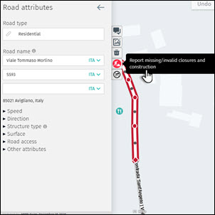
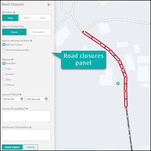
The panel “Road closures” will be activated on the left side. In this panel, you can describe the direction of the closed road, the type of incident and reason, the closure period, sources and additional information.
1.1 Direction
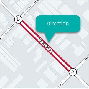
Once you select the road closed, you have to specify the direction of this event, 2 ways, point A to B or B to A.
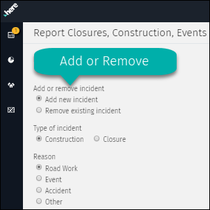
1.2 Add or remove incident
The closure of a road can be reported selecting the option Add new incident, but also can be reported when the road is open again. For this, just select the option Remove existing incident.
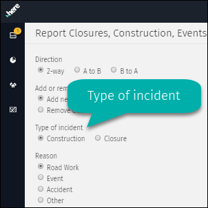
1.3 Type of incident
The road can be closed due to a temporal situation, like a construction or can be totally closed by a permanent event. This option allows to define the current situation in a general way.
1.4 Reason
Once the type of incident is selected you have to define the reason. Only one reason can be selected.
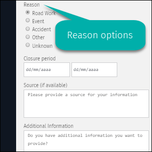
1.4.1 Road work
Road under construction due to various reasons (e.g. improvement in the structure of the path, enlargement etc.).
1.4.2 Event
Usually a temporary situation, like music or sports events, or street markets.
1.4.3 Accident
Vehicular accidents when the road is blocked by structural incidents: hole, road fracture, objects.
1.4.4 Other
Particular situation that is not considered as Road works, Events or Accidents.
1.4.5 Unknown
This option should be selected when the cause of the road closure is not known yet.
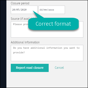
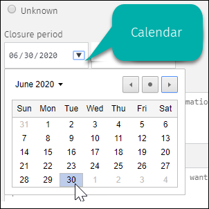
1.5 Closure period
The closure period should be defined based on reality. If this information is not clear, the closure date should be tentative. There are two ways to insert this information: manually or via calendar.
1.5.1 Manually enter
The closure period can be insert following this format: mm/dd/yyyy.
1.5.2 Enter via calendar
The calendar will be displayed using the arrow in the corner of each field.
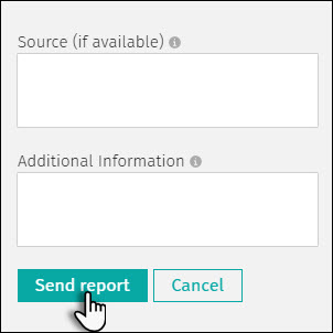
1.6 Source
This field is optional, but it can be very useful in order to process the request quickly. The source provided can be a website with official information about the closure.
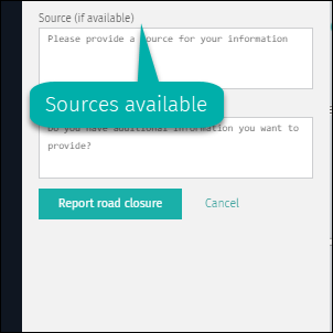
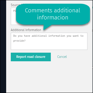
1.7 Additional information
Any additional comment about the incident or why this closure should be removed can be added in this field. All this information is very useful and will be considered in the resolution of your request.
1.8 Submit of cancel report
When all the information has been filled in, the report can be submitted using Send report button. The report will be investigated before publishing and the answer will be provided as soon as possible. If you decide to delete your request, use the Cancel button.
2 Existing road closure reports
Once the report is submitted, the links involved in this request will be assigned with a temporary status, while your request is reviewed by Traffic Team.
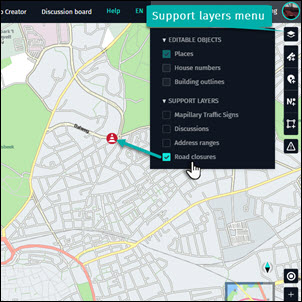
2.1 Road closures in support layers
The status of the submitted requests can be displayed on the map using a support layer. This option allows you to identify which links are reported as closure and the actual status. This support layer can be activated in the layer menu located on the right side of the work space.
2.1.1 Road closure icons
Once the layer is active, the icons for the Road closures will be visible on the map. They will be shown only from the Zoom level 14, as two different icons: Incident caused by construction and Closure on affected roads. When hoover over the icon, the affected road will be selected, being represented by a red color.
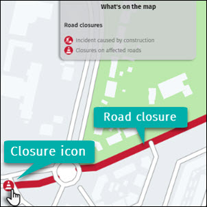
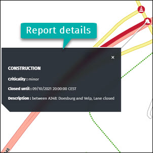
2.1.2 Road closure info
The roads in red color indicate the actual closure status, but if you want to get more details about this road only is necessary to click on the link or on the closure icon. The information on closure dates and the status of the road will be displayed in a new black window linked to the road.