Road attributes – 3 Speed
Speed
Speed information is essential for routing calculations and pre-warnings for speed monitoring. Speed information can be expressed in two ways:
- As a speed limit.
- As an average speed.
Both attributes should be added according to reality.
3.1 Speed limit
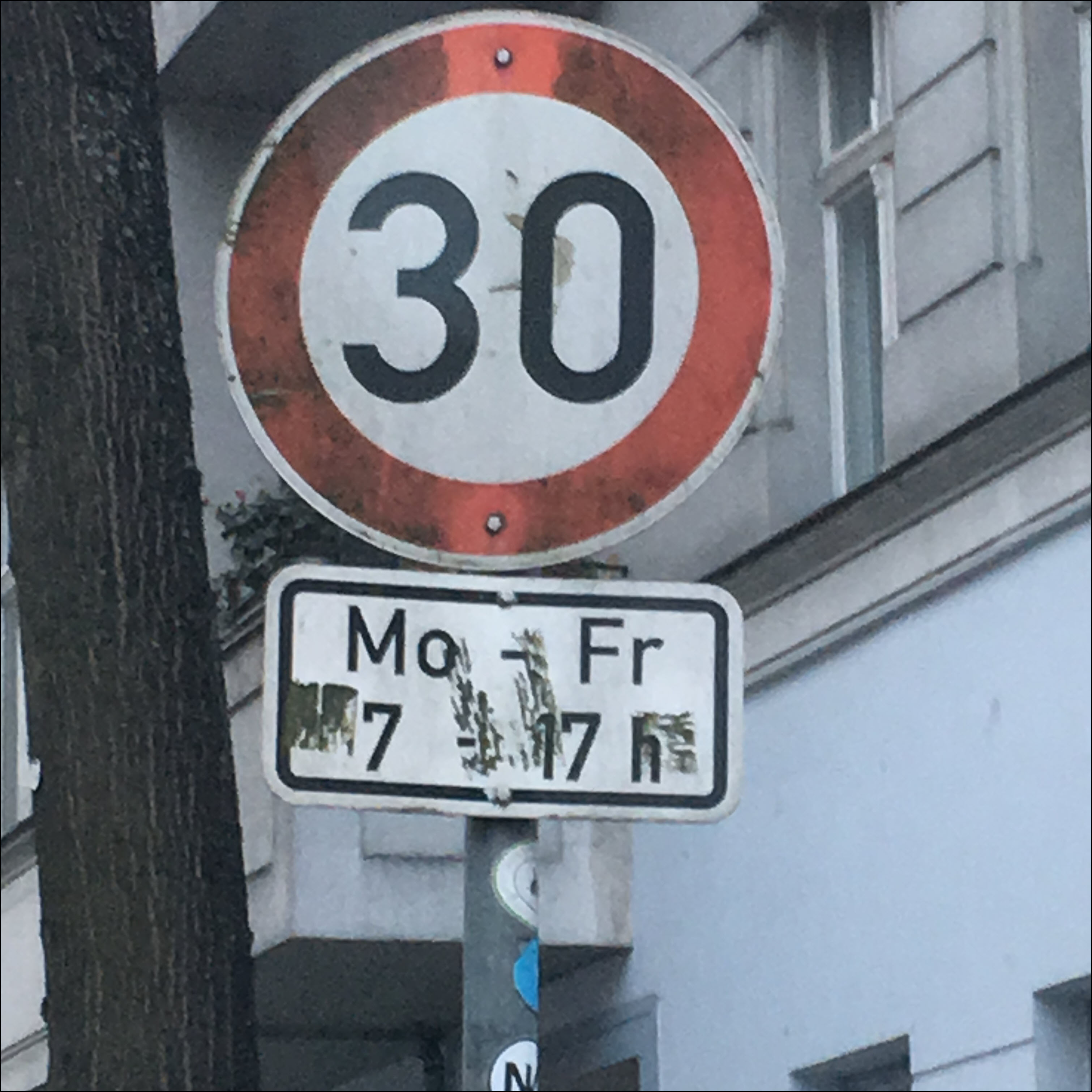
Speed limits are based on posted speed limit signs in reality. Currently in Map Creator, only general speed limits can be implemented, for example:
- Sign posted speed limits.
- Derived speed limits from reference signs according to country-specific driving regulations.
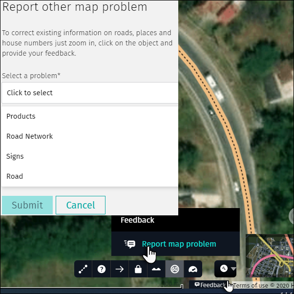
Additional sign information like time-dependency or other special situations (e.g. road construction, rain, lateral wind, animal crossing, etc.) cannot be entered in Map Creator and therefore should not be implemented as a speed limit. In cases like this it is recommended to submit a “Feedback”/”Report map problem”. Enter all information needed to clearly identify the correct location and additional sign information, as below.
Follow the steps below to edit a speed limit:
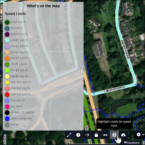
1) Activate the speed limit display and open the map legend to visualize speed limits.
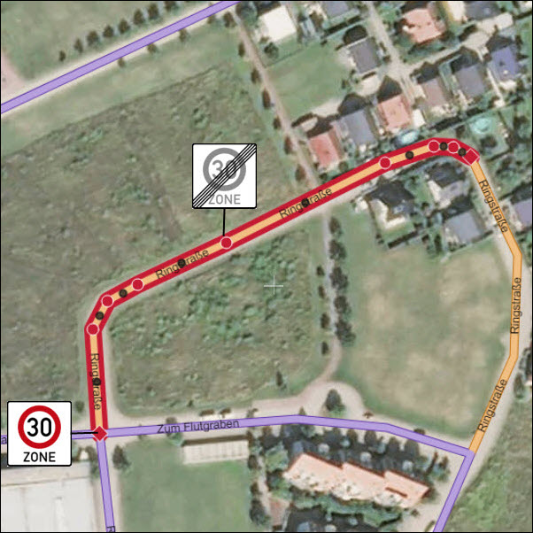
2) Precisely define the start and the end point of the speed limit:
- If the speed limit start and/or end point is not near a node, you will have to create one.
- If the speed limit start and end points correspond with a node (e.g. from intersection to intersection) then there is no need to create additional nodes.
3) To define the start and end point you can use existing nodes or shape points within an accuracy range of 20 m.
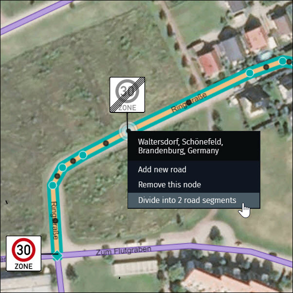
4) Follow these steps to create a node that will separate two segments with different speed limits:
- Right-click on the road,, keeping the mouse pointer in the position where the sign is present.
- Choose “Shape road” and a new shape point will be created at the selected location.
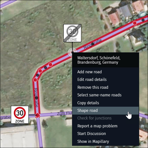
- Highlight the road and right-click on the shape point.
- Select “Divide into 2 road segments” and a node will be created.
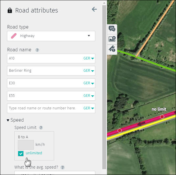
5) After defining the start and end point of the speed limit on the map, select the new road segment and enter the new value into the “Speed limit” field:
- Move the cursor over the fields to identify the direction of your speed limit (A to B or B to A).
- Enter the speed limit value into the correct field.
- Check the opposing side for the correctness of the existing speed limit and update if needed.

Some countries have unlimited speed limits. If this is the case then place a check in the “unlimited” box. After checking the box the numeric speed limit fields are no longer editable.
Note:
- If “0” is entered the numeric speed limit field will revert to blank.
- Values ending in a digit other than 0 or 5 (i.e. 43) will be rounded.
- The smallest value which can be entered is 5.
- The highest value which can be entered is 130.
- Only one numeric speed limit field will be visible on one-way roads.
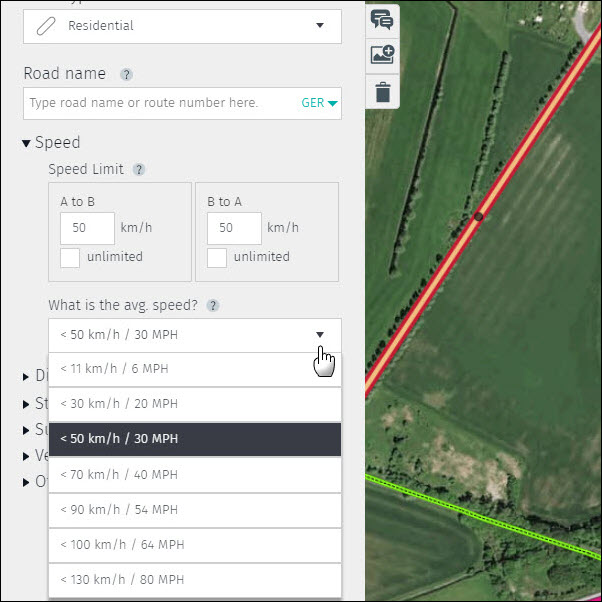
3.2 Average speed
The average speed classifies the overall trend along a road and is entered as a speed range. This can be impacted by the general road conditions (width, surface, slope, curvature etc.) and differs from the speed limit, which is entered based on posted speed limit signs. Therefore it is possible for the speed limit to fall outside of the average speed range.
Average speed ranges are predefined for each road type. If necessary, you can change the average speed range by clicking on the arrow and choosing a new average speed range which best describes the speed trend of the road.