Places and place structure
Map Creator offers the ability to edit Points of Interest (POIs), also called Places. There are almost 400 Places categories and 90+ editable attributes. Places are point data associated to a road segment. The following chapter provides an overview about the structural elements of a place in Map Creator.
1 Place structure
The Place structure is composed of three elements that define the Place object. Those are the Place icon, the display point and the routing point.
1.1 Place icons
Places icons are displayed as round icons containing a symbol that corresponds to Place category. The icon should be positioned at the entrance of the building or the entrance of an open location (e.g. Park-Recreation) where the Place is visible in reality. For some Place categories, more than one icon can mark a single Place, due to multiple entrances (e.g. Underground Train-Subway).
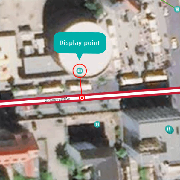
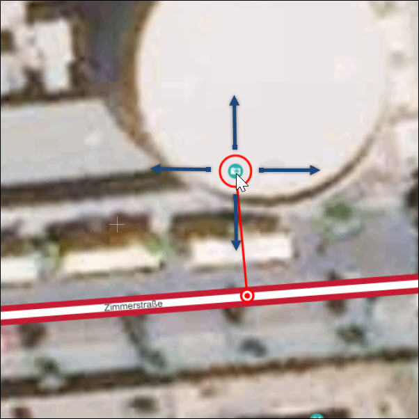
1.2 Display point
The display point, a red circle around the Place icon, appears when clicking on the Place. It can be moved in all directions to identify the location of the entrance of a building or the entrance of an open area.
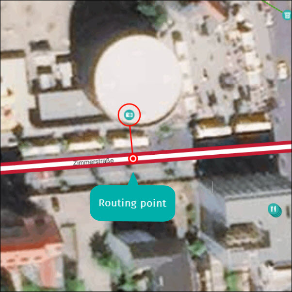
1.3 Routing point
The routing point appears as a red dot on the road segment. This will be added automatically, perpendicular on the closest road, when the place is added. It can then be moved along the road to represent the arrival location or entrance of the Place.

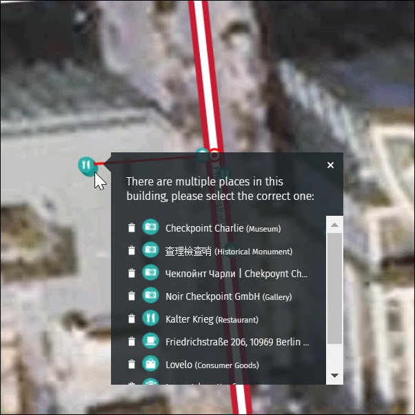
1.4 Stacked places
It is possible that the display point of several Places is located at the same coordinates. In these cases, you will see the stacked Places icon. Hover over the stacked Places icon to see a list of all Places at the same position.