Explore mode vs. edit mode
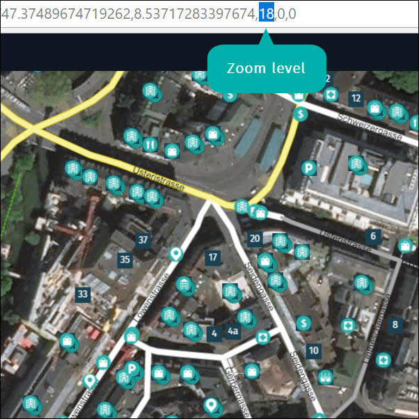
Map Creator has two modes: “Explore mode” and “Edit mode”. The mode that is active depends on the zoom level. You can identify the zoom level via the URL.
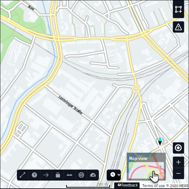
From zoom level 2 to zoom level 15, you are in Explore mode. In this mode, you can see country names and country borders, the road network, major places like airports, green areas, and lakes for orientation purposes. It is not possible to edit features in Explore mode but you can change the map display to “Terrain”, “Satellite”, “Reduced view” or “Night view”.
From level 16 to level 20, you are in Edit mode. Edit mode displays our most up-to-date data, including edits from other Map Creator users that have not been published in HERE products, so there will be differences between Map Creator and products..
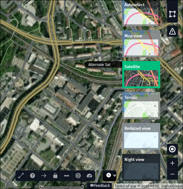
To change the map display, click on the “Map view” button and select from the different options:
Autoselect
- If the map display is set to “Autoselect,” you’ll see the map up to zoom level 15. If you zoom closer, the background changes to satellite images.
Map View
- Click on “Map View” to view the map, regardless of zoom level.
Satellite
- Click on “Satellite” to view satellite imagery, regardless of zoom level.
Terrain
- Click on “Terrain” to view a terrain map, regardless of zoom level.
Reduced view
- Click on “Reduced view” to view a terrain map where the colors of the background are faded. This helps to better identify different objects.
Night view
- Click on “Night view” to view a terrain map with a dark background. This helps to better identify different objects.
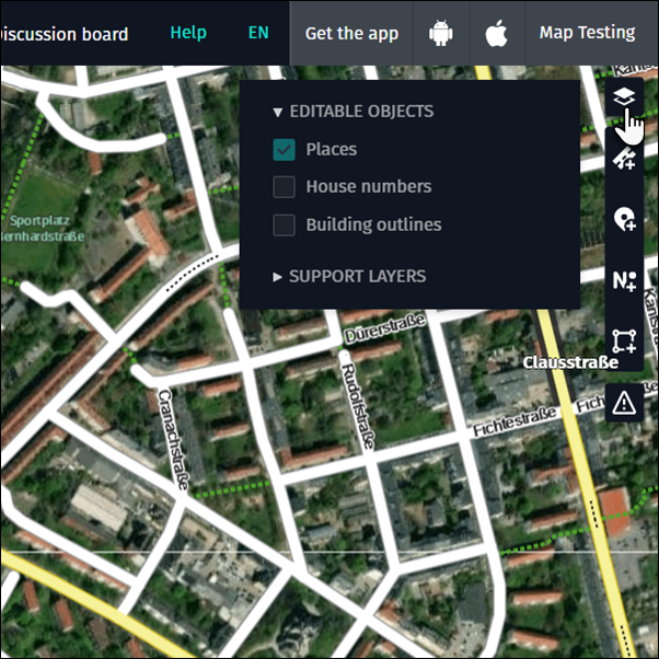
Remember that places, house numbers and buidings are editable at different zoom levels. Make sure the features are editable by checking the “Layer activation bar”.
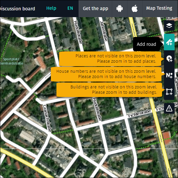
To add, modify and delete roads you need to be at least at zoom level 16. Zoom in further to modify geometry more accurately.
To add, modify and delete places you need to be at least at zoom level 18. Once you reach this level the system will turn on the places layer automatically if you have not manually turned it off before. You can decide if you want to keep the layer on or off by opening the “Editable objects” layer menu on the right and activating or deactivating the checkbox for the places layer.
To add, modify and delete house numbers you need to be at least at zoom level 18. House numbers are not activated automatically – to see house numbers, you need to turn them on in the “Editable objects” layer menu on the right.
To add, modify and delete buildings you need to be at least at zoom level 18. Buildings are not activated automatically – to see buildings, you need to turn them on in the “Editable objects” layer menu on the right.